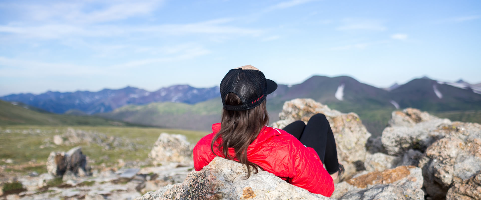
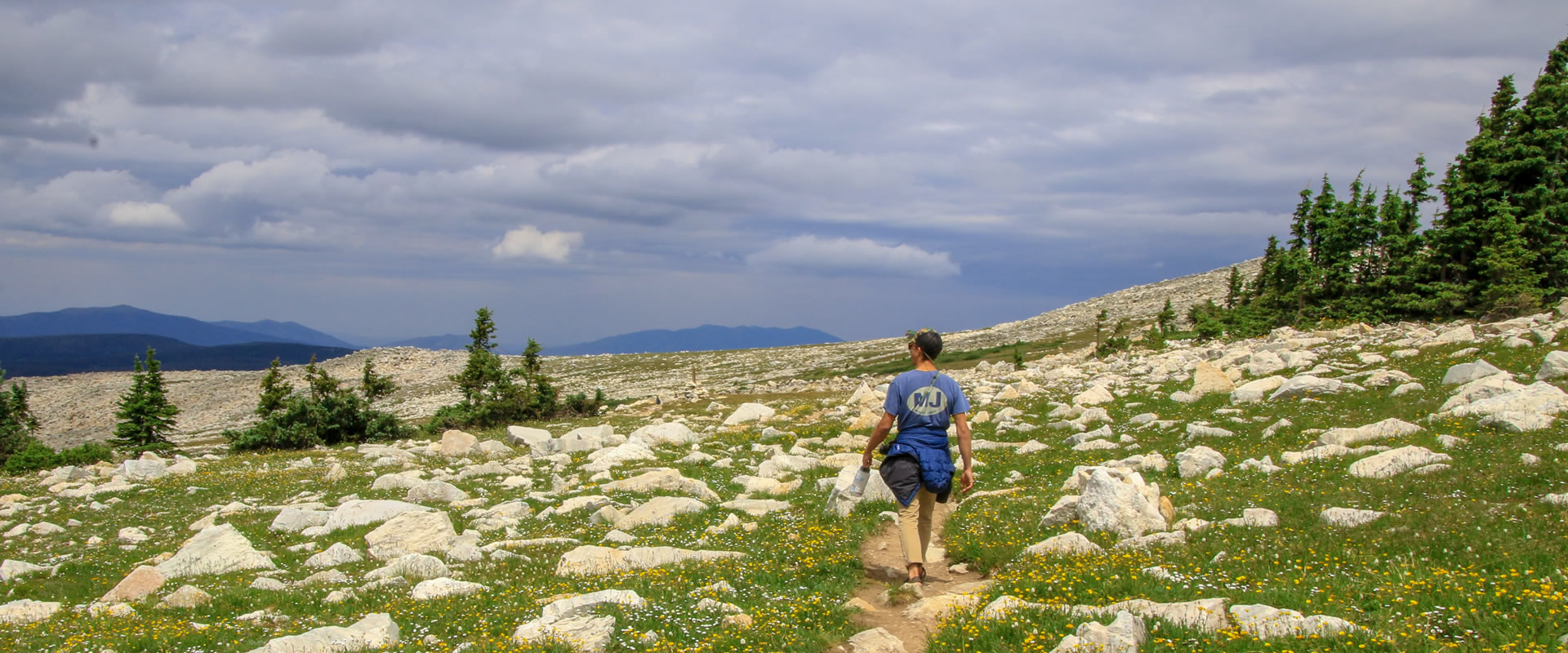
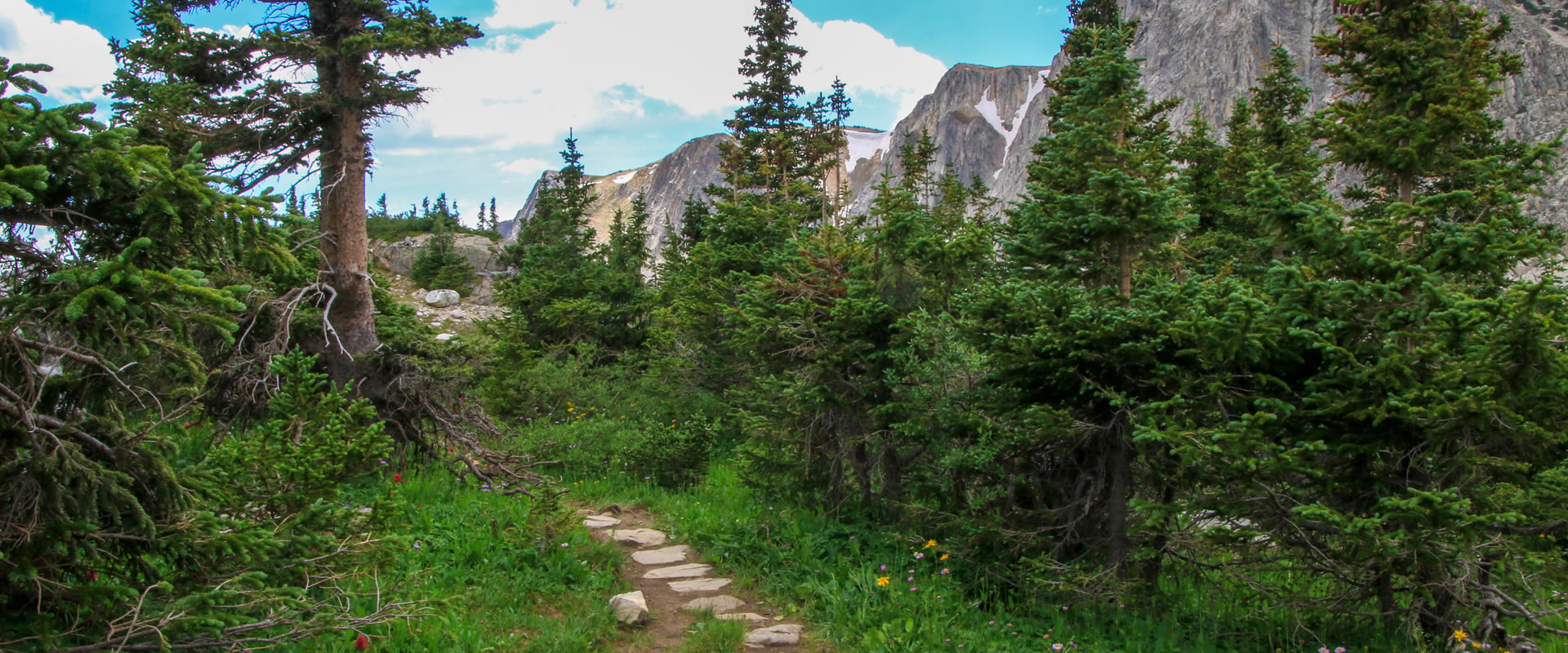
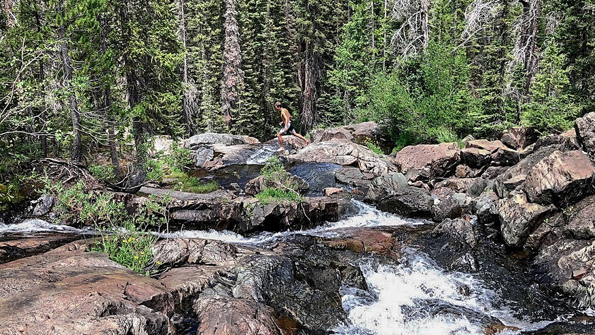
Some of the best places in Carbon County can be accessed by hiking on one of the hundreds of miles of hiking trails in the county.
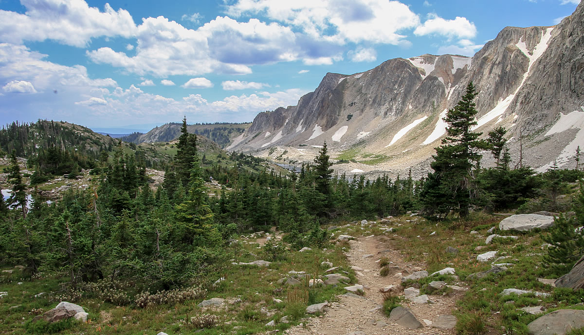
The Medicine Bow National Forest is a prime location for hiking. There are also 5 wilderness areas in the Carbon County region.
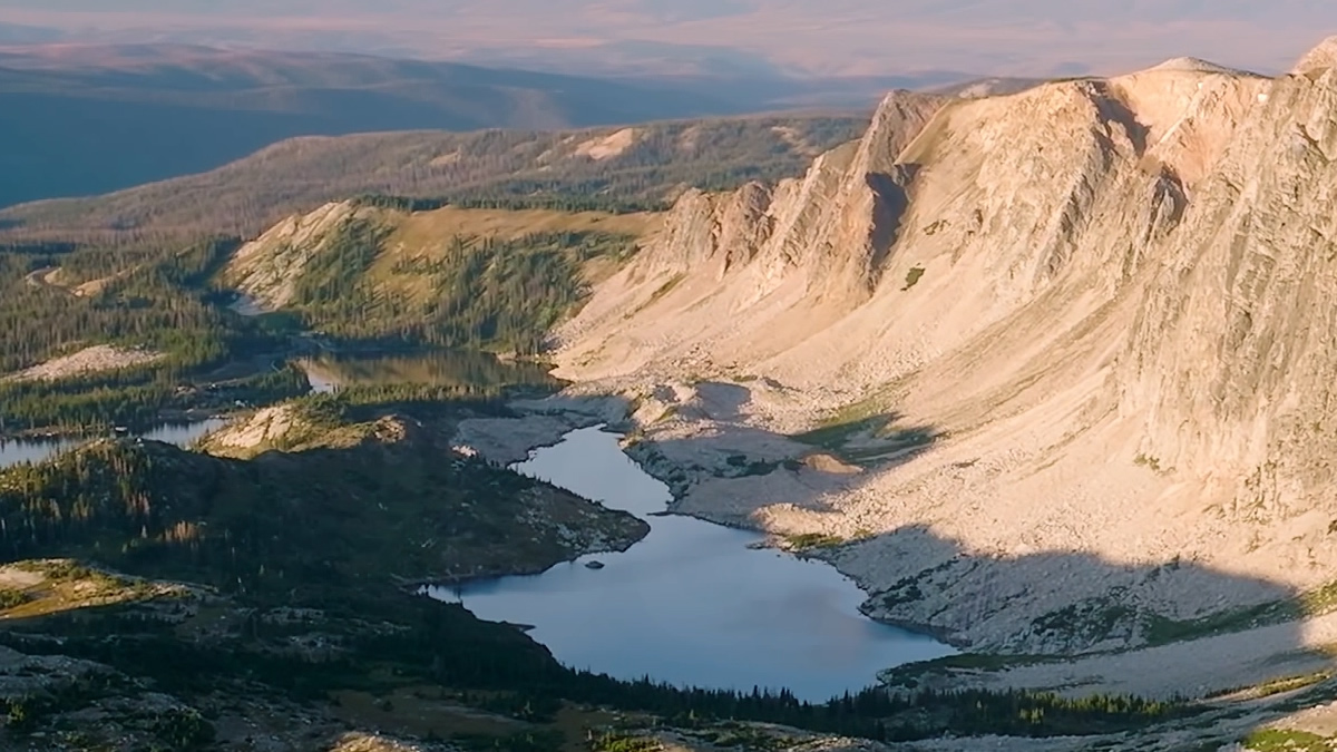
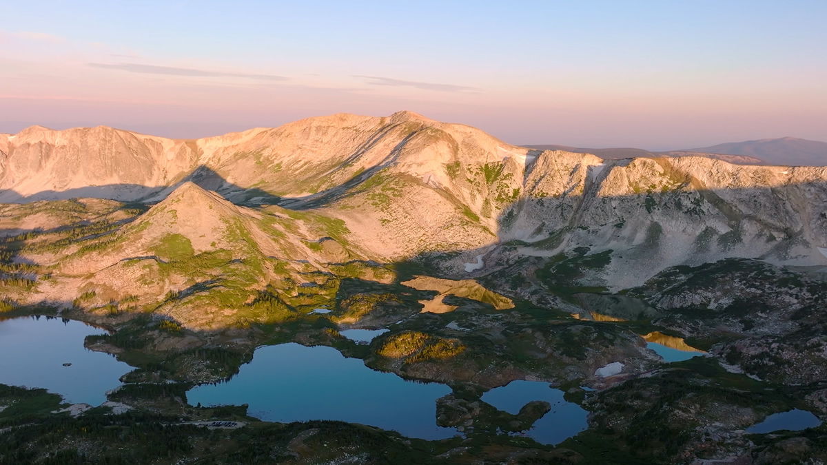
Wild mountain flowers dot trails along the Great Continental Divide and the Snowy Range. Grab your gear and head out on one of our hiking trails for some exciting western adventure. Hiking is one of the best ways to spot wildlife. Visit mountain lakes, crystal clear streams and secret fishing holes. Wyoming’s terrain can be rough and the weather can change fast so make sure that while you enjoy our sweeping natural landscape you come prepared with plenty of water, warm clothes, a compass and a topographic map.
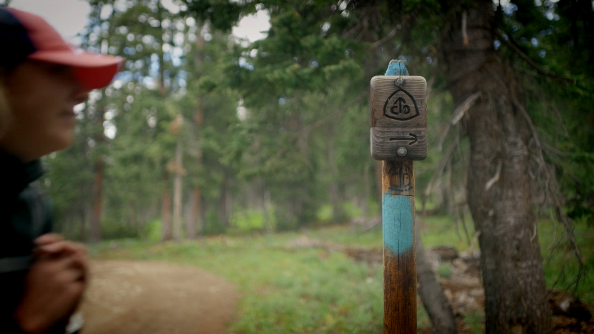
Hiking the Continental Divide Trail
The Continental Divide National Scenic Trail (CDT) traverses through Carbon County. Make plans to hike this epic trail! The CDT is a place to reconnect with nature & meet other hikers from all walks of life. Start planning your journey! https://continentaldividetrail.org/explore-the-trail/
Learn more about the Continental Divide Trail
DOWNLOAD THE CDT COVID-19 RECOMMENDATIONS
Area Hiking Resources
Continental Divide Trail Hiking Resources Visit Website
Hiking & trails in the Medicine Bow Forest: Visit Website
Area wilderness areas: Visit Website
Links to more trail information: Visit Website
Links to Seminoe State Park Hiking Information: Visit Website
Popular Hiking Trails
Baby Lake Trail
Directions: Drive 18 miles west of Encampment on Wyoming Highway 70. Turn south onto National Forest System Road (NFSR) 811. The 811 road forks, take the left fork. The trail head is located about 0.02 miles up the 811 road.
Description: The trail winds through mixed conifer and aspen forests through meadows and across streams in the Huston Park Wilderness area. The trail does not go to Baby Lake but follows Baby Creek and passes many marshes and ponds and is very wet in early summer. The trail is a steep climb uphill from the Baby Lake trail head until you reach the Continental Divide. The trail is marked with rock cairns and tree blazes. These are sometimes difficult to see, always carry a topographic map and be prepared for the wilderness challenge.
Elevation: 10,000 feet
Recommended Season: June-October
Skill Level: Moderate
Length of Trail: 4.7 Miles / 7.6 Km
Roaring Fork Trail
Directions: From Highway 130 turn onto National Forest System Road (NFSR) 100 just after the Forest Boundary. Drive for about 9 miles until you come to the intersection with NFSR 205, turn east (right) on to the 205 road. Travel for about one mile until the road ends.
Description: Trail winds through mixed conifer and aspen forests, through meadows and across streams. The trail is gradually uphill until you reach the wilderness boundary.
Elevation: 9,920 feet
Recommended Season: June-October
Skill Level: Easy
Length of Trail: 7.9 Miles / 12.7 Km
Huston Park Wilderness
Description:
Huston Park Wilderness rises beyond 10,500 feet and contains alpine bogs and stands of lodgepole pine, spruce, fir, and aspen, interspersed with open parks and brushy meadows. The streams are small and their water drains into the Little Snake and North Platte Rivers. Some of the streams harbor trout that are there for the catching. Straddling the Continental Divide, this area includes 45.9 miles of the Continental Divide National Scenic Trail, at an average elevation of 9,750 feet. This section of the Divide Trail is called the Huston Park Trail, undeveloped and marked with rock cairns and blazed trees. Many views are panoramic and spectacular. The Baby Lake, Verde Mine, and Roaring Fork Trails offer side trips, but these pathways are also undeveloped and lack well-marked trailheads.
Elevation: 9,750 feet
Recommended Season: June-October
Skill Level: Difficult
Length of Trail: 45.9 Miles / 73.9 Km
Verde Mine Trail
Directions: To reach the Verde Mine trailhead take Highway 70 to National Forest System Road (NFSR) 807. Drive for about 6 miles until you reach NFSR 851. Drive on 851 for approximately 8.5 miles to NFSR 851.1D. Continue east on 851.1D for about 4 miles to the trailhead. This road is recommended only for four-wheel drive and high clearance vehicles.
Description: The trail winds through mixed conifer and aspen forests. The Verde Mine trail travels through the Huston Park Wilderness area and accesses the Continental Divide National Scenic trail. Please be aware of special wilderness regulations, carry topographic maps, and be prepared for wilderness challenge.
Elevation: 9,920 feet
Recommended Season: June-October
Skill Level: Moderate
Length of Trail: 4.6 Miles / 7.4 Km
Green Mountain Falls Trail
Directions: Drive west of Encampment for 6 miles on Wyoming State Highway 70. Turn onto National Forest System Road (NFSR) 550. Continue driving for another 2 miles until you reach NFSR 550.2H. Take the 550.2H road and drive approximately 1.5 to the trailhead, there are signs marking the way (this trailhead is also referred to as the North Fork trailhead). The 550.2H road is recommended for four-wheel drive and high clearance vehicles only.
Description: The trail winds through mixed conifer and aspen forests. The trail ends at the spectacular Green Mountain Falls. The Green Mountain Falls trail accesses the Huston Park Wilderness area
Elevation: 8,680 feet
Recommended Season: June-October
Skill Level: Easy
Length of Trail: 1.7 Miles / 2.7 Km
Green Mountain Trail
Directions: Drive west of Encampment for 6 miles on Wyoming State Highway 70. Turn onto National Forest System Road (NFSR) 550. Continue driving for 5.7 miles until you reach NFSR 406. Take the 406 road and drive approximately 1.5 to the trailhead, there are signs marking the way.
Description: The trail winds through mixed old growth conifer forest. The trail access the Continental Divide National Scenic Trail and the Huston Park Wilderness area, please be aware of special wilderness regulations, carry topographic maps, and be prepared for the wilderness challenge.
Elevation: 10,040 feet
Recommended Season: June-October
Skill Level: Moderate
Length of Trail: 1.5 Miles / 2.4 Km
Encampment River Trail
Directions: To access the Commissary Park trailhead turn off of Wyoming State Highway 230 onto County Road 211. Drive for approximately 7 miles until you reach the Forest boundary. The road will change to National Forest System Road (NFSR) 409. Continue driving for another 6 miles until you reach NFSR 496. Take the 496 road and drive approximately 10 miles to the trailhead at Commissary Park. Be sure to make a right-hand turn where the road meets NFSR 80. The trailhead is located on the north side of the road.
Description: The trail winds through mixed conifer and aspen stands along the Encampment River. This trail travels through the Encampment River Wilderness area, please be aware of special wilderness regulations, carry topographic maps, and be prepared for the wilderness challenge.
Elevation: 8,360 feet
Recommended Season: June-October
Skill Level: Easy
Length of Trail: 2.8 Miles / 4.5 Km
East Fork Trail
Directions: Travel east of Riverside on Wyoming Highway 230 for approximately one mile. Turn off onto County Road 211. Drive for approximately 7 miles until you reach the Forest boundary. The road will change to National Forest System Road (NFSR) 409. Continue driving for 9 miles until you reach the trailhead (stay on the 409 road). The trailhead is located on the west side of the road.
Description: The trail winds through mixed conifer, aspen forests, and willow stands along the East Fork Encampment River.
Elevation: 9,840 feet
Recommended Season: July-October
Skill Level: Moderate
Length of Trail: 7.27 Miles / 11.7 Km
Big Creek Trail
Directions: Turn off of Wyoming State Highway 230 on to County Road 798. Drive for approximately 5 miles until you reach the Forest boundary. The road will change to National Forest System Road (NFSR) 498. Continue driving for another 3 miles until you reach NFSR 498.2A, this will take you to an access point along the Big Creek trail at the South Fork of Big Creek.
Description: Trail winds through mixed conifer, aspen forests, and willow stands along Big Creek. The trail is marked with posts and tree blazes. These are sometimes difficult to see, always carry a topographic map. The trail ends at the Forest Boundary. The trail turns into a road after crossing Big Creek via a bridge.
Elevation: 8,400 feet
Recommended Season: June-October
Skill Level: Moderate
Length of Trail: 5 Miles / 8.1 Km
Tie Hack Trail
Directions: Take Wyoming Highway 130/230 south of Saratoga approximately 7.5 miles. Turn on to Wyoming Highway 130; drive east for approximately 16.5 miles, until you reach National Forest System Road (NFSR) 225. Take NFSR 225 for approximately 5 miles, until you reach the northern trailhead on the south side of the road. The trailhead is located just before the junction of NFSR 227.
Description: The Tie Hack Trail winds through the typical spruce-pine forest of the region. It closely follows North French Creek and crosses it several times. There are currently four bridges and one water crossing. Only one of these bridges is designed for horses.
Elevation: 8,640 feet
Recommended Season: Late May - November
Skill Level: Moderate
Length of Trail: 4 Miles / 6.4 Km
Platte River Trail
Directions: Travel east of Riverside, on Wyoming Highway 230 for approximately 22 miles until you come to National Forest System Road (NFSR) 492. Turn left onto NFSR 492 (there will be a highway sign reading “Six Mile”) and travel for about 2 miles until you come to the Six Mile campground. Go through the campground to a graveled parking area, this is the Six Mile trailhead.
Description: The trail follows the North Platte River through the Platte River Wilderness Area. The Platte River trail will take you through a Lodgepole and Ponderosa pine forest. The trail crosses the river at Stovepipe and enters the Laramie District. There are special regulations for traveling in wilderness, please consult the local Ranger Districts for information.
Elevation: 7,800 feet
Recommended Season: June - October
Skill Level: Moderate
Length of Trail: 7.7 Miles / 12.4 Km
Campbell Lake Trail
Directions: From Highway 130 turn onto National Forest System Road (NFSR) 100 just after the Forest Boundary. Drive for about 9 miles until you come to the intersection with NFSR 205, turn east (right) on to the 205 road. Travel for about one mile until the road ends.
Description: The Campbell Lake trail passes through pine forests and open meadows on closed road number 205 and ends at Arrastre Lake where the road is again open to full size vehicles. A short side-trail leads to Campbell Lake. From the trail head the trail is steep and uphill for the first 1.5 miles.
Elevation: 10,240 feet
Recommended Season: June-October
Skill Level: Moderate
Length of Trail: 3.1 Miles / 4.9 Km
Bottle Creek Trail
Directions: Drive west of Encampment for approximately 8 miles on Wyoming State Highway 70. Go past the Forest Boundary to the large parking lot (on the west side of the highway) at the seasonal closure gate.
Description: The loop trails, which make up the Bottle Creek Trails, wind through aspen, lodgepole pine stands, and reclaimed clear-cuts. The trails provide a range of distances for hikers from the South Brush Creek Campground or for motorists needing to stretch their legs. The trails are maintained to provide cross-country skiing and snow shoeing opportunities in the winter. Restroom facilities are available at the Bottle Creek campground.
Elevation: 8,760 feet
Recommended Season: June-October
Skill Level: Difficult
Length of Trail: 8.3 Miles / 13.4 Km
Brush Creek Trail
Directions: Take Wyoming Highway 130/230 south of Saratoga approximately 7.5 miles. Turn onto Wyoming Highway 130; drive east for approximately 14 miles to the Brush Creek Visitor Center. The trailhead is located just north of the visitor center.
Description: The loop trails, which make up the Brush Creek Trails, wind through aspen, lodgepole pine stands, and reclaimed clear-cuts. The trails provide a range of distances for hikers from the South Brush Creek Campground or for motorists needing to stretch their legs.
Elevation: 8,120
Recommended Season: June-October
Skill Level: Difficult
Length of Trail: 10 Miles / 16.1 Km
Hog Park Creek Trail
Directions: Drive west of Encampment for 6 miles on Wyoming Highway 70. Turn onto National Forest System Road (NFSR) 550. Drive for approximately 14.5 miles until you reach NFSR 496. Take the 496 road and drive approximately 3.5 miles to the trailhead. The trailhead is on the north side of the road just before the road crosses a cattle guard.
Description: The trail winds through mixed conifer and aspen forests. The Hog Park Creek trail travels through the Encampment River Wilderness area and accesses the Encampment River trail.
Elevation: 8,320 feet
Recommended Season: June - October
Skill Level: Easy
Length of Trail: 1.3 Miles / 2.1 Km
Miner’s Cabin Trail
Directions: Take Wyoming Highway 130/230 south of Saratoga approximately 7.5 miles. Turn onto Wyoming Highway 130 drive east for approximately 28 miles to the Miner’s Cabin trailhead. The trailhead is located off of Highway 130 (Snowy Range Scenic Byway) before Libby, Flats heading east.
Description: The Miner’s Cabin trail is very easy. This is an excellent trail to observe wildflowers from in the spring. The interpretive signs along the way explain the activities of early miners and tie hacks that once inhabited the Medicine Bow National Forest. There are remnants of historical mines and cabins.
Elevation: 10,858 feet
Recommended Season: July-October
Skill Level: Easy
Length of Trail: 0.7 Miles / 1.1 Km
Meadow Falls
Directions: Take Wyoming Highway 130/230 south of Saratoga approximately 7.5 miles. Turn onto Wyoming Highway 130; drive east for approximately 25 miles to the Silver Lake campground. The trailhead is located just before you enter the campground and picnic area on the right-hand side of the road. Parking is available at the Silver Lake Picnic area.
Description: The Meadow Falls trail winds through Engleman spruce and Lodgepole pine forest. It loops around to meet the Silver Lake trail.
Elevation: 10,480 feet
Recommended Season: June - October
Skill Level: Moderate
Length of Trail: 2.8 Miles / 4.5 Km
Silver Lake Trail
Directions: Take Wyoming Highway 130/230 south of Saratoga approximately 7.5 miles. Turn onto Wyoming Highway 130; drive east for approximately 25.5 miles to the Silver Lake trailhead. The trailhead is located on the south side of Highway 130 approximately 0.2 miles past Silver Lake campground.
Description: The Meadow Falls trail winds through Engleman spruce and Lodgepole pine forest. It loops around to meet the Silver Lake trail.
Elevation: 10,820 feet
Recommended Season: July - October
Skill Level: Moderate
Length of Trail: 1.7 Miles / 2.7 Km
French Creek Canyon Trail
Directions: To reach the Tipple trailhead take Wyoming Highway 130/230 south of Saratoga approximately 7.5 miles. Turn onto Wyoming Highway 130; drive east for approximately 26.5 miles to the Tipple trailhead across the highway from Lake Marie parking area.
Description: The French Creek Canyon trail on the northern end begins via the Tipple trail #293. The trail goes steadily downhill and passes through open meadows and spruce-pine forest. It winds along French Creek and passes Sunshine Falls, a beautiful waterfall. The trail crosses a tributary of French Creek the bridge at this crossing may not be suitable for bikes. This is a popular trail for hikers and fishermen.
Elevation: 10,480 feet
Recommended Season: June-October
Skill Level: Moderate
Length of Trail: 5.3 Miles / 8.5 Km
Medicine Bow Peak Trail
Directions: Take Wyoming Highway 130/230 south of Saratoga approximately 7.5 miles. Turn onto Wyoming Highway 130 drive east for approximately 26.5 miles to the Lake Marie Parking Area. The trailhead is located in the Lake Marie parking area.
Description: The Medicine Bow Peak trail is very steep and follows switchbacks up the highest points on the Snowy Range. It is not recommended to hike this trail after 3:00 pm due to the chance of lightning. Storms are known to blow in unexpectedly, be prepared! The trail reaches the summit of Medicine Bow Peak before it descends down to meet the Lakes trail.
Elevation: 10,480 feet
Recommended Season: July-October
Skill Level: Difficult
Length of Trail: 5.3 Miles / 8.5 Km
The Lakes Trail
Directions: Take Wyoming Highway 130/230 south of Saratoga approximately 7.5 miles. Turn onto Wyoming Highway 130, drive east for approximately 27 miles to the Mirror Lake Picnic Area. The trailhead is located on the north end of the picnic area. When traveling east on highway 130, the picnic area is located approximately 0.5 miles past the Lake Marie Parking area
Description: The Lakes trail connects to the Medicine Bow Peak trail. It is not recommended to hike this trail after 3:00 pm due to the chance of lightning. Storms are known to blow in unexpectedly, be prepared! The Lakes trail winds through meadows and sparse Engleman spruce and Limber pine forest. Hikers will come to Mirror Lake and Lookout Lake.
Elevation: 11,800 feet
Recommended Season: July-October
Skill Level: Easy
Length of Trail: 1.8 Miles / 2.9 Km
Dipper Lake Trail
Directions: Drive east on Highway 130 from Saratoga for approximately 26.5 miles to the Lake Marie Parking Area. The trailhead is located in the Lake Marie parking area.
Description: The Dipper Lake trail begins near Dipper Lake. The trail winds through meadows and sparse Engleman spruce and Limber pine forest. Hikers will come to the Heart Lake and can access the Medicine Bow Peak trail #295.
Elevation: 11,400 feet
Recommended Season: July-October
Skill Level: Difficult
Length of Trail: 3.4 Miles / 5.5 Km
Vagner Lake Trail
Directions: From Wyoming Highway 130 take National Forest System Road (NFSR) 200 (turn north, a left hand turn). Travel approximately one mile on NFSR 200 until you reach the junction with NFSR 103. Travel approximately 3.5 miles on NFSR 103 until you reach the trailhead. It is located on the east side of the road near a historical cabin. The NFSR 103 is only recommended for high clearance, narrow, four-wheel drive vehicles
Description: The Vagner Lake trail begins in an open grassy meadow near a historical Tie Hack cabin. The Vagner Lake trailhead is shared with the Quealy Lake trail. Users will travel to Vagner Lake. The trail winds through meadows and sparse Engleman spruce and Limber pine forest.
Elevation: 10,420 feet
Recommended Season: July-October
Skill Level: Moderate
Length of Trail: 0.5 Miles / 0.8 Km
Heart Lake Trail
Directions: Take Wyoming Highway 130/230 south of Saratoga approximately 7.5 miles. Turn onto Wyoming Highway 130 drive east for approximately 23 miles to National Forest System Road (NFSR) 200 (turn north, a left hand turn). Travel approximately one mile on NFSR 200 until you reach the junction with NFSR 103. Travel approximately three miles on NFSR 103 until you reach the trailhead near Dipper Lake. The Heart Lake trail branches off of the Dipper Lake trail. Hikers can also reach the Heart Lake trail from the Medicine Bow Peak trail. The Medicine Bow Peak trailhead is located off of Highway 130 at the Lake Marie Parking Area.
Description: The Heart Lake trail winds through meadows and sparse Engleman spruce and Limber pine forest. Hikers will come to Dipper Lake, Upper Long Lake, and Heart Lake. The Heart Lake trail also connects to the Medicine Bow Peak trail.
Elevation: 10,760 feet
Recommended Season: July-October
Skill Level: Moderate
Length of Trail: 0.3 Miles / 0.5 Km
Sheep Lake Trail
Directions: Take Wyoming Highway 130/230 south of Saratoga approximately 7.5 miles. Turn onto Wyoming Highway 130 drive east for about 14 miles to National Forest System Road (NFSR) 100, just after the Forest Boundary. Drive on the 100 road for about 19.5 miles to the trailhead located on the west side of the road, just past the Deep Creek campground.
Description: The Sheep Lake trail begins in a lodgepole pine and engleman Spruce forest. The change in elevation is 1,300 feet and the trail is primarily above tree line. Users will pass Big Brooklyn Lake, Snowbank Lake, Twin Lakes, Sheep Lake, Mutt Lake, and Jeff Lake.
Elevation: 10,720 feet
Recommended Season: June-October
Skill Level: Moderate
Length of Trail: 7.8 Miles / 12.6 Km
Crater Lake Trail
Directions: From Wyoming Highway 130 drive east for about 14 miles to National Forest System Road (NFSR) 100. Drive on the 100 road for about 19 miles to the 101 road. Turn south (right) on the 101 road and drive for about 9 miles to NFSR 113. Turn north (left) and travel approximately 2 miles to the trailhead. The trailhead is approximately 2 miles north of the Deep Creek Campground.
Description: This trail travels along the north side of Stillwater Reservoir, a water impoundment completed in 1940. At 0.8 miles there is a registration/information board and the jct. with trail #1120. Please register and become familiar with posted information.
The trail turns north and reaches the Flat Tops Wilderness Boundary at mile 1.0. Continuing, you pass Little Causeway Lake at mile 1.6. From here you climb along and through talus slopes to the Bear River/ E. Fork of the Williams Fork watersheds divide at mile 2.3. A side trail makes a steep ascent to the Devils Causeway possible.
The trail descends quickly and reaches Causeway Lake at mile 5.7. At mile 7.0 is Round Lake and the jct. with trail #1116. From here, the trail descends, crosses and follows the E. Fork of the Williams Fork. Trail #1117 is intersected at mile 8.9. Further on, you re-cross the river and climb to the jct. with trail #1116 at mile 11.6. Heading down valley, trail 1172 is at mile 13.0, the Wilderness Boundary at mile 13.4, and the end of the trail at Pyramid Guard Station at mile 15.7.
Elevation: 9,220 feet
Recommended Season: June-October
Skill Level: Difficult
Length of Trail: 2 Miles / 3.2 Km
Rock Creek Trail
Directions: The northern trailhead is located at Arlington. Off of Interstate Highway 80 exit at Arlington, follow the signs to Forest Access and the Rock Creek trail. There is also a short access trail from the Deep Creek campground.
Description: The Rock Creek trail begins in an open meadow near Sand Lake. The trailhead is shared with the Sheep Lake trail. The trail runs through lodgepole pine and Engleman spruce forest. It primarily follows Rock Creek but gets above the creek and parallels the canyon walls in some places. This provides scenic panoramic views.
Elevation: 10,020 feet
Recommended Season: June-October
Skill Level: Moderate
Length of Trail: 11.1 Miles / 17.9 Km
Ralph Hesson Fishing Pier
Directions: Take Wyoming Highway 130/230 south of Saratoga approximately 7.5 miles. Turn onto Wyoming Highway 130 drive east for approximately 21 miles to the fishing pier located a short distance to the south of highway 130.
Description: The Fishing pier is dedicated to Ralph Hesson a Forest Service volunteer. This pier is an accessible interpretive trail.
Elevation: 9,720 feet
Recommended Season: June-October
Skill Level: Easy
Length of Trail: 0.2 Miles / 0.3 Km